s = f(cl, b, r, p, t) - dedemae.files.wordpress.com · •proses lebih lanjut membentuk horison b...
TRANSCRIPT
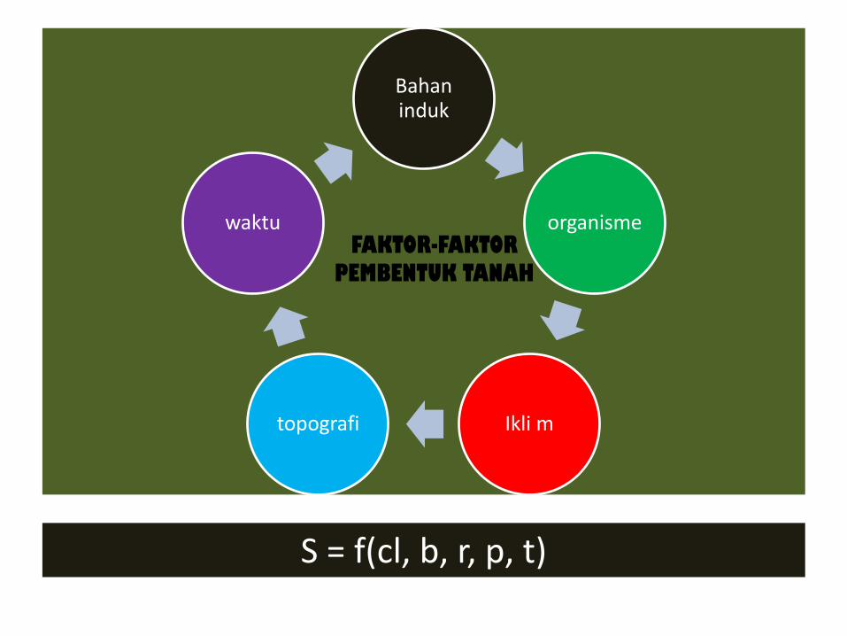
Bahan induk
organisme
Ikli m topografi
waktu FAKTOR-FAKTOR
PEMBENTUK TANAH
S = f(cl, b, r, p, t)

Faktor-faktor pasif: sumber masa pembentuk tanah dan kondisi-kondisi yang mempengaruhinya Bahan induk, relief, waktu
Faktor-faktor aktif Agen-agen yang menyediakan energi yang bekerja diatas masa Iklim, jasad hidup

Sifat bahan induk menentukan sifat tanah
• Batuan beku asam, quartzose, stand stone melapuk sangat lambat- tanah pasir kasar, basa rendah, liat kaolinit, tidak subur.
• Batuan beku basa+ batuan sedimen mudah lapuk tekstur halus, basa tinggi, liat monmorilonit, subur
Pengaruh bahan induk sangat tampak pada stadia awal pembentukan tanah

Pengaruh Bahan Induk terhadap Sifat Tanah
• Tekstur BI berpengaruh langsung terhadap tekstur
tanah muda
• Tekstur dari mineral sukar lapuk masih terlihat pada tanah tua
• BIdg tekstur halus tanah BO tinggi
• BI tekstur terlalu halus permeabilitas solum tipis
• Tingkat pelapukan BI tgt jenis mineral. Mineral mudah lapuk mineral baru (liat) cepat terjadi
• BI basa mineral monmorilonit
• Cadangan hara tanah dipengaruhi oleh mineral pada bahan induk( Kalsit : Ca, Dolomit : Ca, Mg)

BAHAN INDUK
• Pembagian batuan induk :
1. Batuan beku
2. Batuan Sedimen
3. Batuan metamorfose

BATUAN BEKU terbentuk karena magma yg membeku
1. Batuan beku atas : Magma membeku di permukaan bumi Berd. SiO2 batuan beku : asam, intermedier, alkalis Abu vulkan amorf(tipe vitrik) + fragmen (tipe litrik) tanah subur (Andosol/Andisol)
2.Batuan beku dalam: Magma membeku di dalam bumi
3.Batuan beku gang (terobosan) : Magma membeku diantara sarang magma dan permukaan bumi

BATUAN SEDIMEN
1. Batuan endapan tua Bahan endapan (laut) yang mengendap jutaan tahun
+ membentuk batuan keras Batu gamping : karang laut : CaCO3 +
CaMg(CO3) Batu pasir : pasir kuarsa (SiO2) Batu liat : asam/alkalis, kadar liat tinggi
2. Bahan endapan baru : belum menjadi batu •Diendapkan oleh air, mis di daerah dataran banjir •Diendapkan oleh angin, mis. Pasir pantai

BATUAN METAMORFOSE
Berasal dari batuan beku atau sedimen yang berubah karena suhu dan tekanan tinggi menjadi jenis batuan lain.
1. Tekstur lembar(foliated texture) – Lembar halus(schist) : mika schist
– Lembar kasar (gneis) : granit gneis
2. Tidak bertekstur : – Kwarsit (dari batu pasir)
– Marmer (dari batu kapur karbonat)


Gneis
Schist

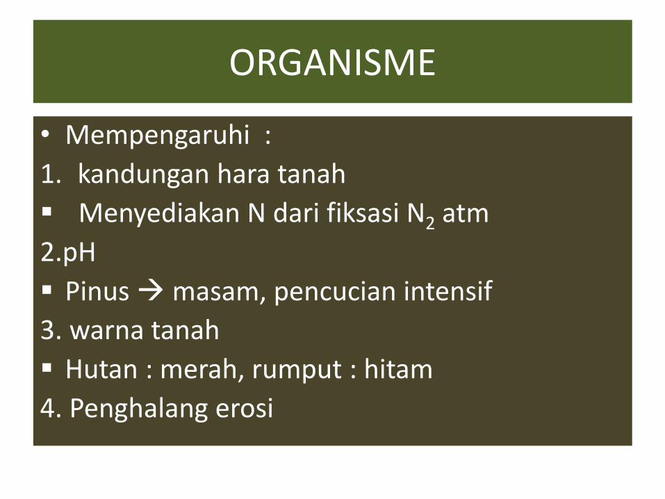
ORGANISME
• Mempengaruhi :
1. kandungan hara tanah
Menyediakan N dari fiksasi N2 atm
2.pH
Pinus masam, pencucian intensif
3. warna tanah
Hutan : merah, rumput : hitam
4. Penghalang erosi


IKLIM
1. Suhu
• T naik 10oC kec. Reaksi naik 2 X
• T tanah mempengaruhi reaksi oleh mo
• T naik pelapukan + pembentukan liat naik

2.Curah Hujan
• Reaksi kimia berjalan cepat
• Pelapukan+ pencucian lanjut tanah asam + rendah hara
• Bila tinggi :
• Kation basa tercuci dari A B,
• Horison A : Al dan H
• pH turun(asam)
• BO + liat tinggi

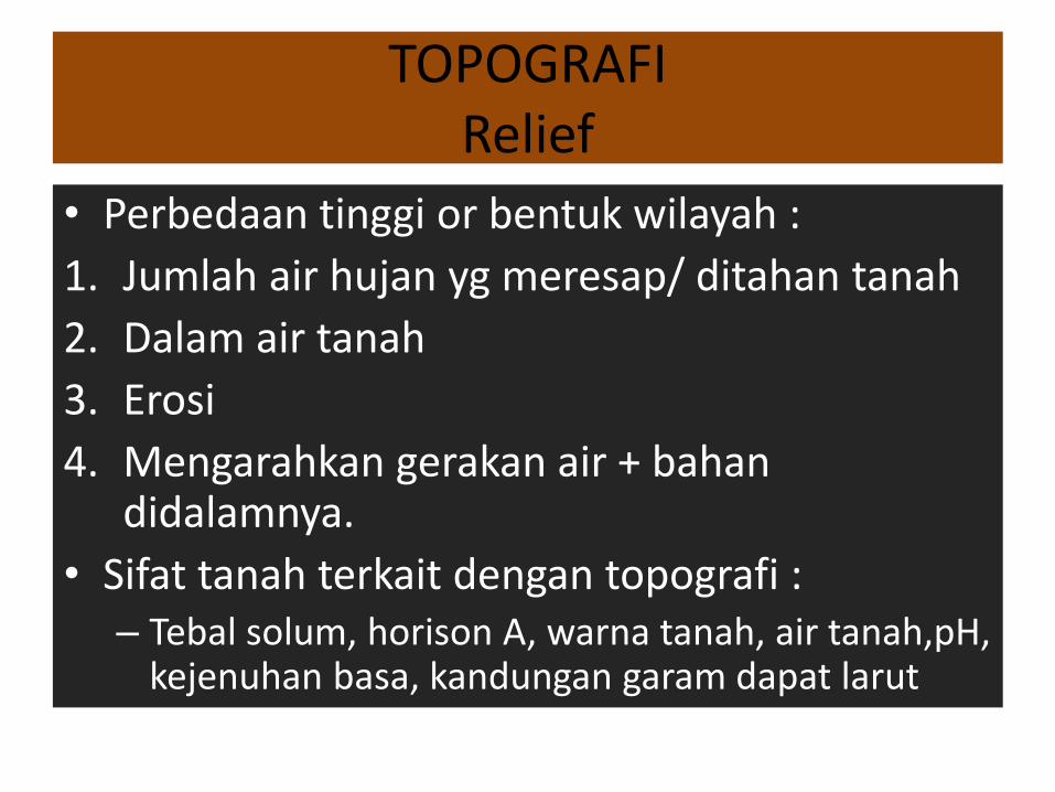
TOPOGRAFI
Relief • Perbedaan tinggi or bentuk wilayah :
1. Jumlah air hujan yg meresap/ ditahan tanah
2. Dalam air tanah
3. Erosi
4. Mengarahkan gerakan air + bahan didalamnya.
• Sifat tanah terkait dengan topografi : – Tebal solum, horison A, warna tanah, air tanah,pH,
kejenuhan basa, kandungan garam dapat larut

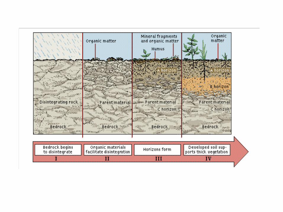
WAKTU
• Tanah mpk benda alam yang terus menerus berubah, karena pelapukan + pencucian.
Tanah muda : Pelapukan bahan organik + bahan mineral Pencampuran bahan organik +bahan mineral di permukaan tanah Terbentuk horison A dari horison O. Sifat tanah didominasi oleh sifat bahan induk Entisol ( Aluvial, Regosol

• Tanah Dewasa
• Proses lebih lanjut membentuk horison B
• Pelapukan + pencucian belum lanjut
• Hara tersedia
• Inceptisol ( Latosol coklat, Andosol), Vertisol, Mollisol.
Tanah Tua •Perubahan horison A dan B menjadi A, E, EB, BE, Bt, (Bs), (Bo), BC •Pelapukan mineral + pencucian basa meningkat mineral sukar larut tanah kurus + masam. •Ultisol (Podsolik Merah Kuning) ,Oxisol (Laterit)
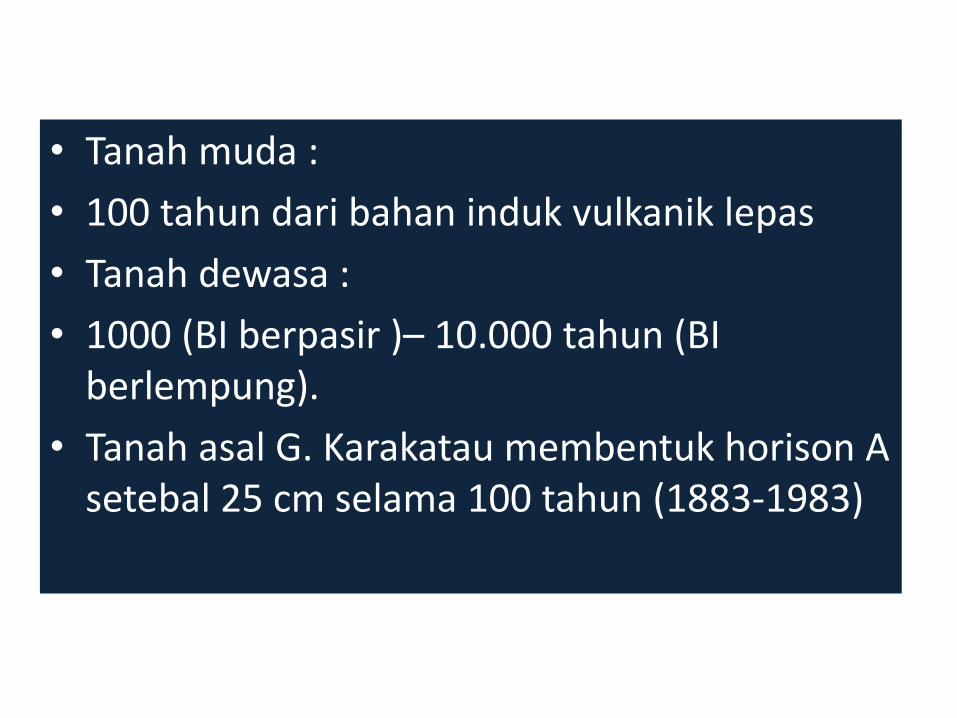
• Tanah muda :
• 100 tahun dari bahan induk vulkanik lepas
• Tanah dewasa :
• 1000 (BI berpasir )– 10.000 tahun (BI berlempung).
• Tanah asal G. Karakatau membentuk horison A setebal 25 cm selama 100 tahun (1883-1983)


National Cooperative Soil Survey National Cooperative Soil Survey provides a dynamic resource of soils information for a wide range of needs.
National Landslide Information Center (USGS) The National Landslide Information Center (NLIC) is responsible for distributing information about landslides to
the lay public, researchers, planners, and local, state, and federal agencies.
Planet Earth (Discovery.com) The Discovery Planet Earth site features a variety of interesting information, reports, and links on Earth science
and related subjects.
Recent Landslide Events (USGS) A listing with descriptions and explanations of recent landslide events from the United States Geological Survey
(USGS).
Soil Erosion Research Laboratory The United States Department of Agriculture's (USDA) National Soil Erosion Laboratory home page.
Soil Profile Photo Gallery Soil profile photographs from the United States Department of Agriculture.
Soil Science Journal—Soils Online This soil science online journal page offers many links to related Web sites.
Soils and Substrates: World-Wide Web Virtual Library An informative site that includes a comprehensive listing of soils related WWW sites.
Soils and Soil Science Links Soils and soil science links from National Soil Survey Center, Iowa State University.
Soils Links This Central Michigan University site maintained by Dr. Mark Francek lists several good links to Web sites
containing information relative to topics discussed in the chapter.

Soil Science Society of America
The Soil Science Society of America (SSSA) is the professional home for over 6,000 professionals throughout
the world dedicated to the advancement of soil science. The primary purpose of the Society is to advance
the discipline and practice of soil science by acquiring and disseminating information about soils in relation to
crop production, environmental quality, ecosystem sustainability, bioremediation, waste management and
recycling, and wise land use.
Soil Web Sites
Links to soil related sites from the National Soil Survey Center (NSSC-USDA).
U.S. Department of Agriculture
Weathering and Soils Links (Houghton Mifflin)
Links to several weathering and soils sites, including class lecture notes, arranged by topic.
Weathering Images
Several good photographs of various weathering phenomena hosted by Duke University.


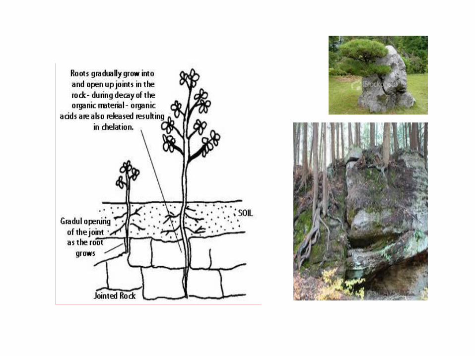
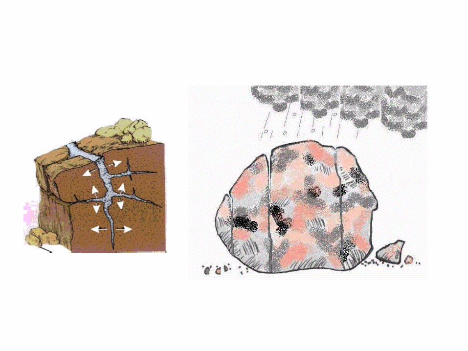
Pelapukan biologis