dasar-dasar google maps api
TRANSCRIPT
Pengoperasion Google Maps API
Pengantar Google API1
“
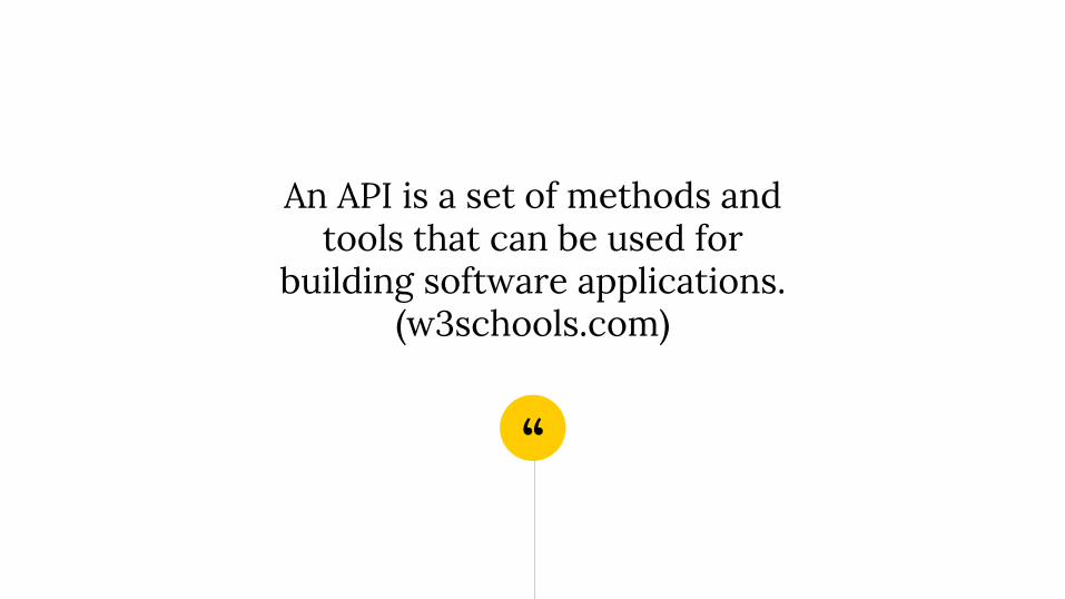
An API is a set of methods and tools that can be used for
building software applications. (w3schools.com)

“
API berarti kode program yang merupakan antarmuka atau penghubung antara aplikasi atau web yang kita buat
dengan fungsi-fungsi yang dikerjakan.

“
Misalnya Google API, berarti kode program yang dapat kita tambahkan
pada aplikasi atau web kita untuk mengakses / menjalankan /
memanfaatkan fungsi atau fitur yang disediakan Google.
Instructions for useOpen this document in Google Slides (if you are at slidescarnival.com use the button below this presentation)
You have to be signed in to your Google account
EDIT IN GOOGLE SLIDES
Go to the File menu and select Make a copy.
You will get a copy of this document on your Google Drive and will be able to edit, add or delete slides.
EDIT IN POWERPOINT®
Go to the File menu and select Download as Microsoft PowerPoint. You will get a .pptx file that you can edit in PowerPoint.
Remember to download and install the fonts used in this presentation (you’ll find the links to the font files needed in the Presentation design slide)
More info on how to use this template at www.slidescarnival.com/help-use-presentation-template
This template is free to use under Creative Commons Attribution license. If you use the graphic assets (photos, icons and typographies) provided with this presentation you must keep the Credits slide.
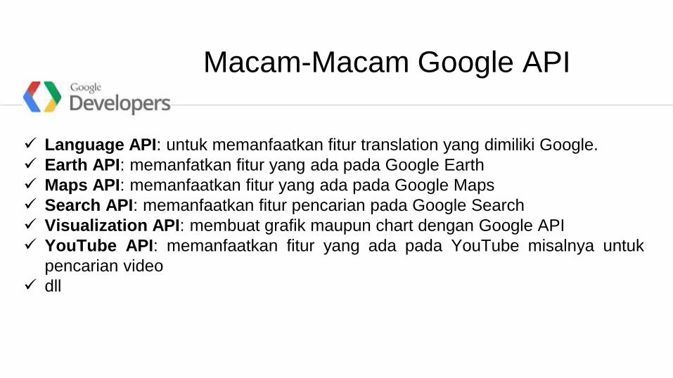
Language API: untuk memanfaatkan fitur translation yang dimiliki Google.
Earth API: memanfatkan fitur yang ada pada Google Earth
Maps API: memanfaatkan fitur yang ada pada Google Maps
Search API: memanfaatkan fitur pencarian pada Google Search
Visualization API: membuat grafik maupun chart dengan Google API
YouTube API: memanfaatkan fitur yang ada pada YouTube misalnya untuk
pencarian video
dll
Macam-Macam Google API
Google Maps API2
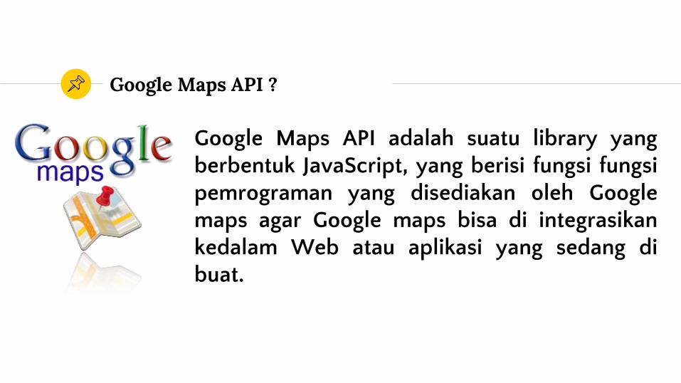
Google Maps API ?
Google Maps API adalah suatu library yangberbentuk JavaScript, yang berisi fungsi fungsipemrograman yang disediakan oleh Googlemaps agar Google maps bisa di integrasikankedalam Web atau aplikasi yang sedang dibuat.
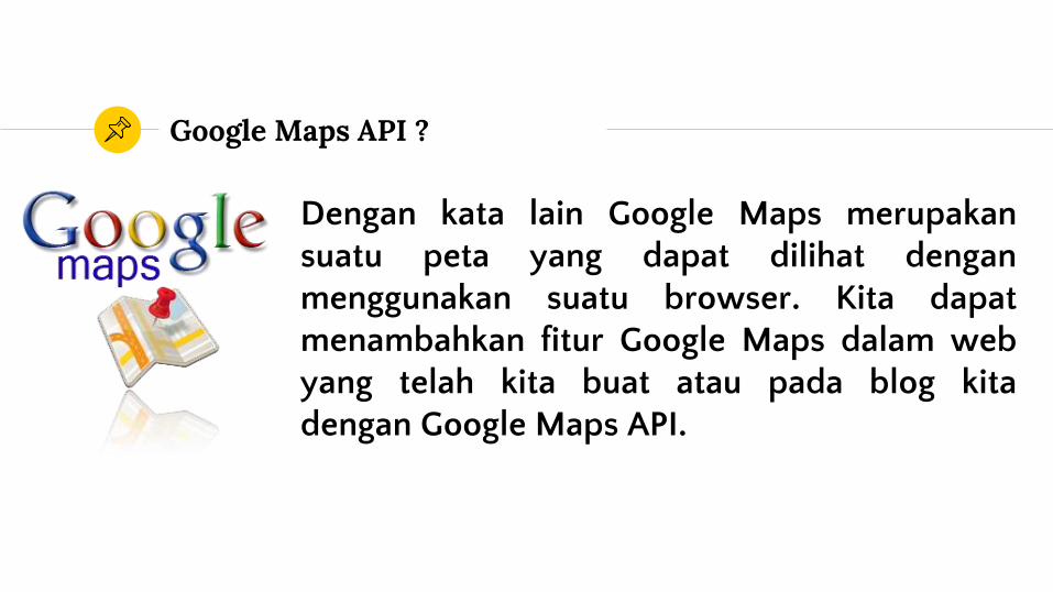
Google Maps API ?
Dengan kata lain Google Maps merupakansuatu peta yang dapat dilihat denganmenggunakan suatu browser. Kita dapatmenambahkan fitur Google Maps dalam webyang telah kita buat atau pada blog kitadengan Google Maps API.
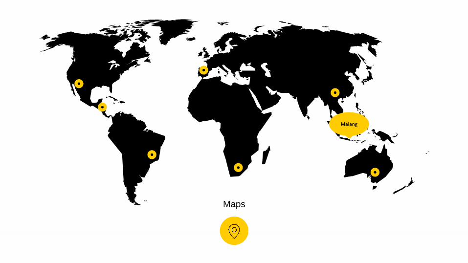
Maps
Malang
Mendapatkan Key Google Maps API
3
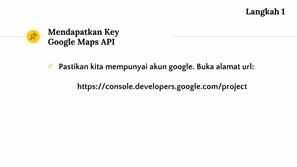
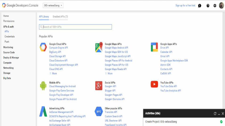
Pastikan kita mempunyai akun google. Buka alamat url:
https://console.developers.google.com/project
Mendapatkan Key Google Maps API
Langkah 1
Mendapatkan Key Google Maps API
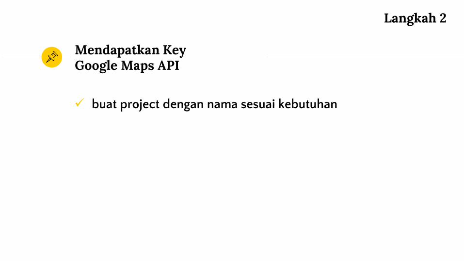
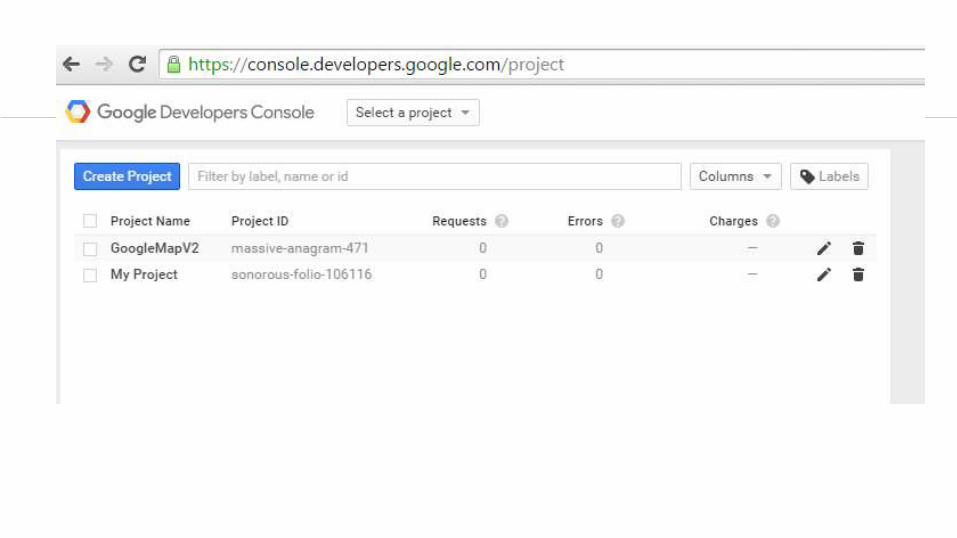
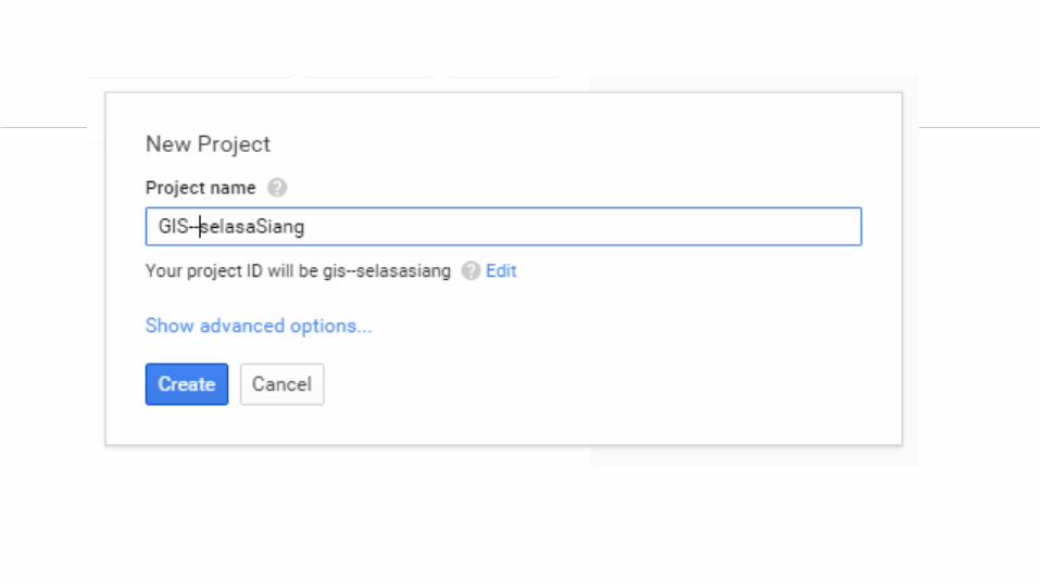
buat project dengan nama sesuai kebutuhan
Mendapatkan Key Google Maps API
Langkah 2
Pastikan kita mempunyai akun google dan buat project untuk mendapat API Google maps key. Buka alamaturl:
https://console.developers.google.com/project
Mendapatkan Key Google Maps API
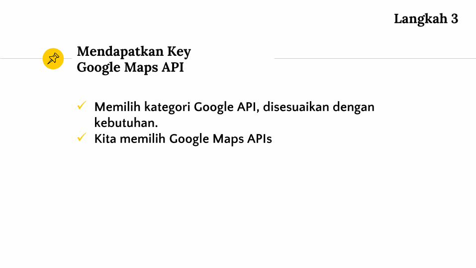
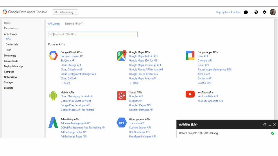
Memilih kategori Google API, disesuaikan dengankebutuhan.
Kita memilih Google Maps APIs
Mendapatkan Key Google Maps API
Langkah 3
buat project dengan nama sesuai kebutuhan
Mendapatkan Key Google Maps API
Langkah 3
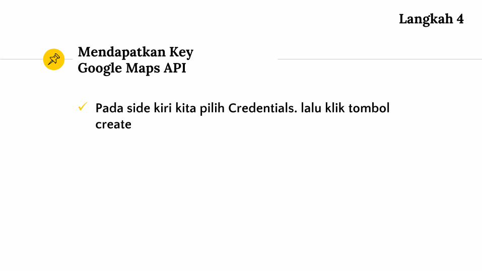
Pada side kiri kita pilih Credentials. lalu klik tombolcreate
Mendapatkan Key Google Maps API
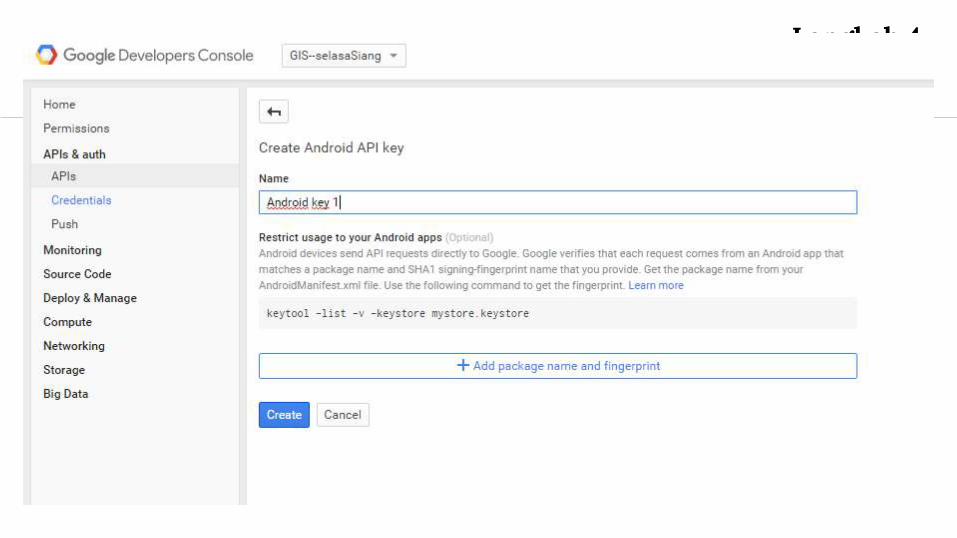
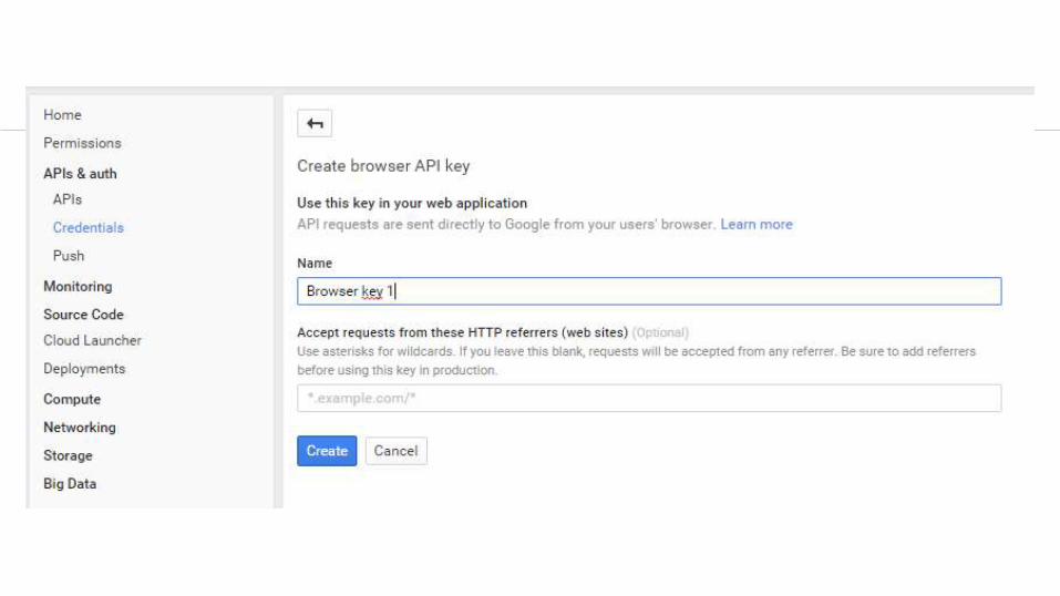
Langkah 4
Mendapatkan Key Google Maps API
Langkah 4
Mendapatkan Key Google Maps API
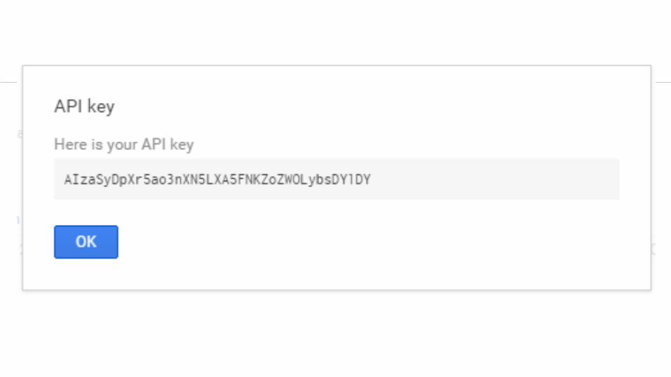
Klik, OK Kita sudah mendapatkan key google maps API
Mendapatkan Key Google Maps API
Langkah 5
Mendapatkan Key Google Maps API
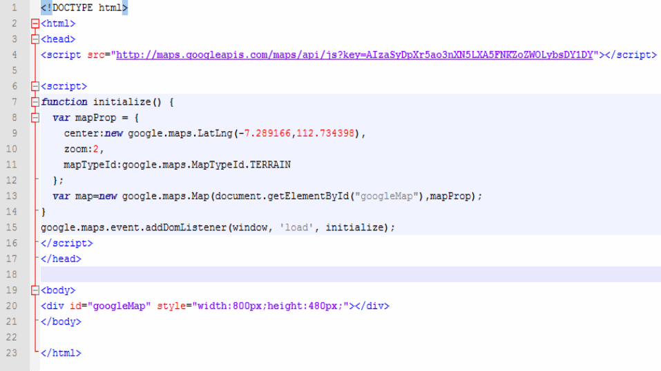
Mengoperasikan Google Maps API
4
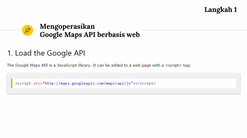
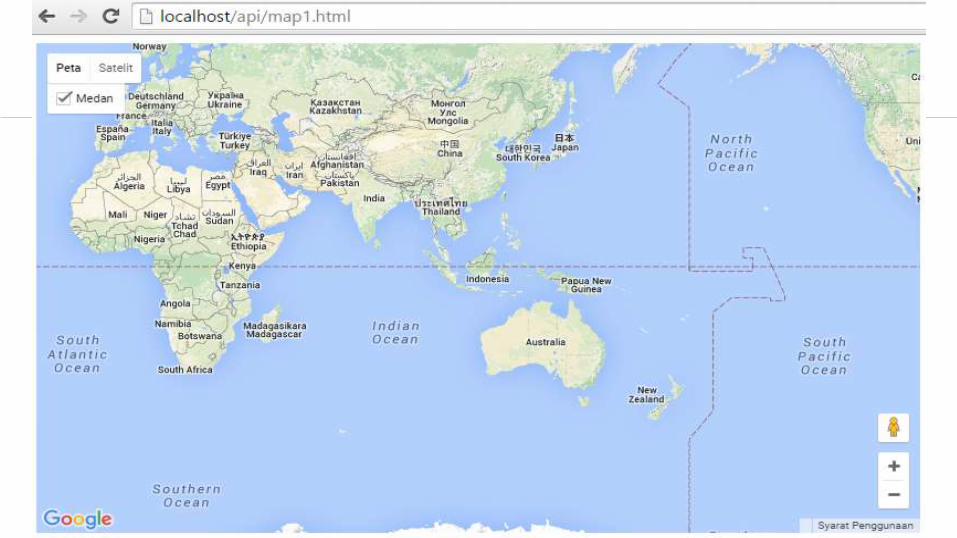
MengoperasikanGoogle Maps API berbasis web
Langkah 1
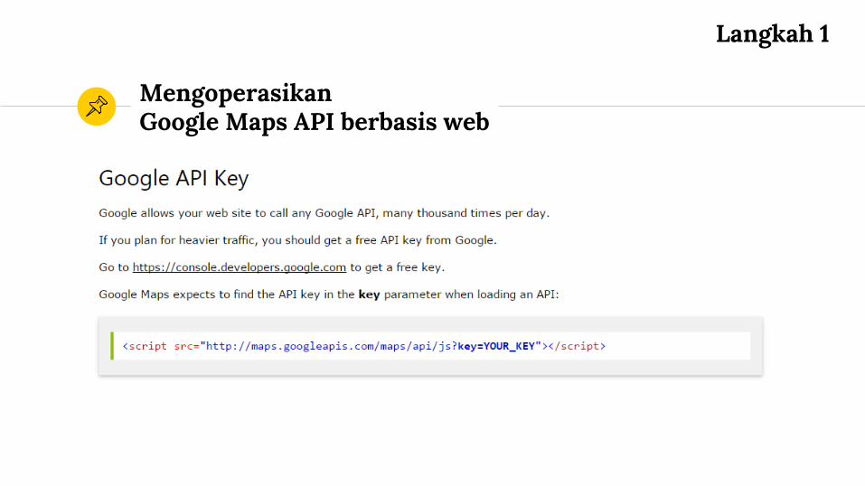
MengoperasikanGoogle Maps API berbasis web
Langkah 1
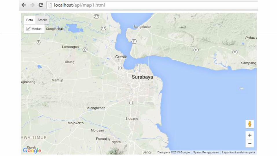
MengoperasikanGoogle Maps API berbasis web
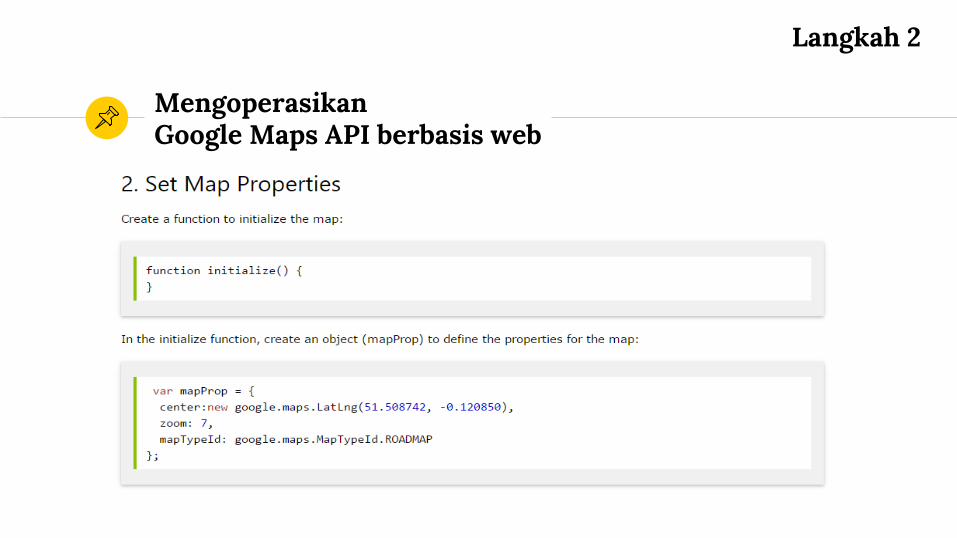
Langkah 2
MengoperasikanGoogle Maps API berbasis web
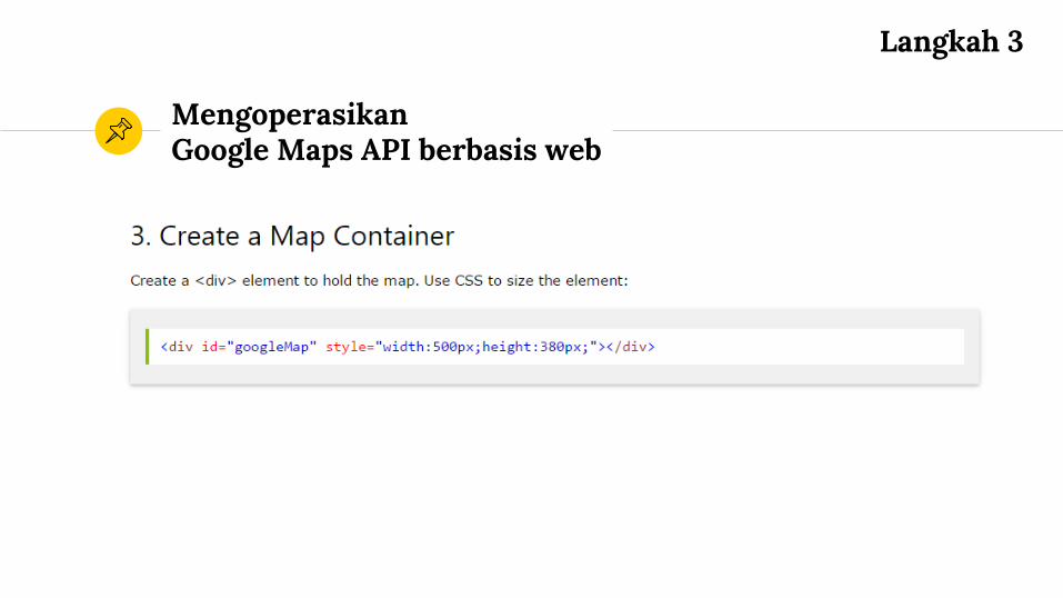
Langkah 3
MengoperasikanGoogle Maps API berbasis web
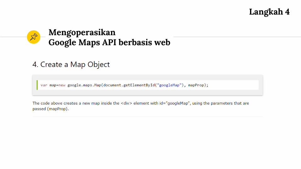
Langkah 4
In two or three columns
In two or three columns
In two or three columns
Tipe-Tipe Google Maps
4
Use charts to explain your ideas
GrayWhite Black

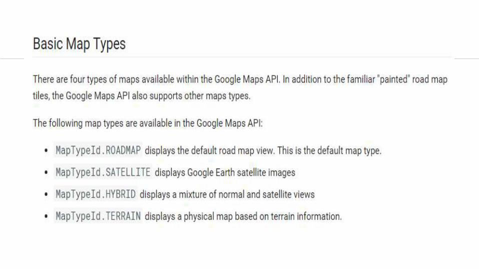
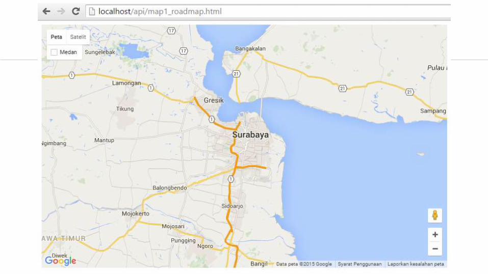
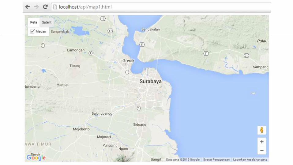
Tipe Roadmap
untuk menampilkan peta biasa 2 dimensi
And tables to compare data
A B C
Yellow 10 20 7
Blue 30 15 10
Orange 5 24 16
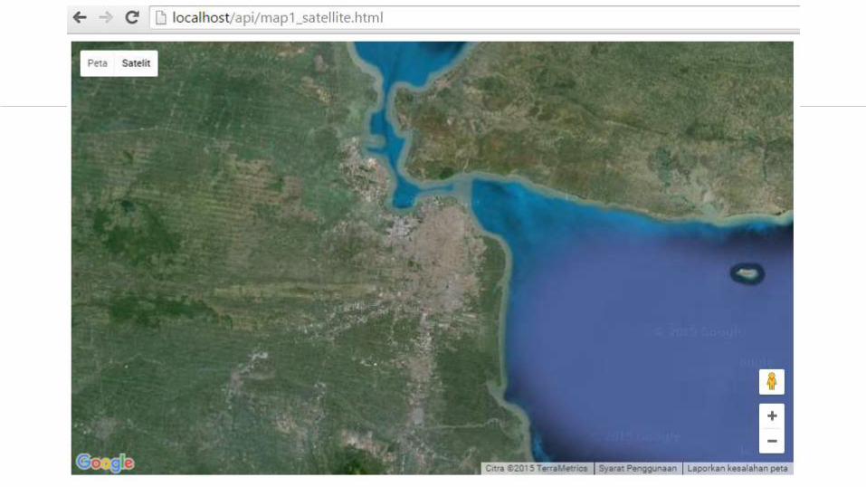
Tipe Satellite
untuk menampilkan foto satelit
And tables to compare data
A B C
Yellow 10 20 7
Blue 30 15 10
Orange 5 24 16
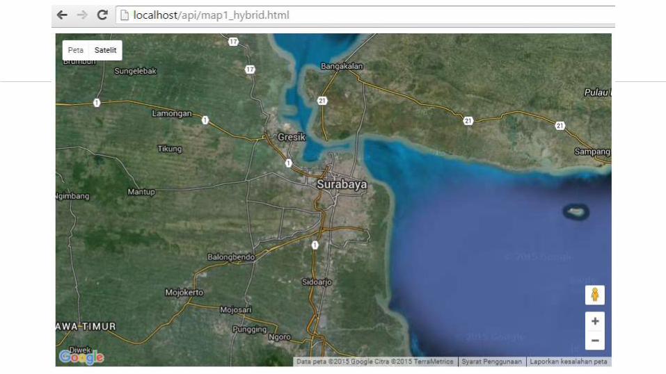
Tipe Hybrid
akan menunjukkan foto satelit yang
diatasnya tergambar pula apa yang tampil
pada ROADMAP (jalan dan nama kota)
And tables to compare data
A B C
Yellow 10 20 7
Blue 30 15 10
Orange 5 24 16

Tipe Terrain
untuk menunjukkan relief fisik permukaan
bumi dan menunjukkan seberapa tingginya
suatu lokasi, contohnya akan menunjukkan
gunung dan sungai
And tables to compare data
A B C
Yellow 10 20 7
Blue 30 15 10
Orange 5 24 16

Maps
Malang

SEKIAN