jesse m. urbancsik portfolio 2016 c
TRANSCRIPT
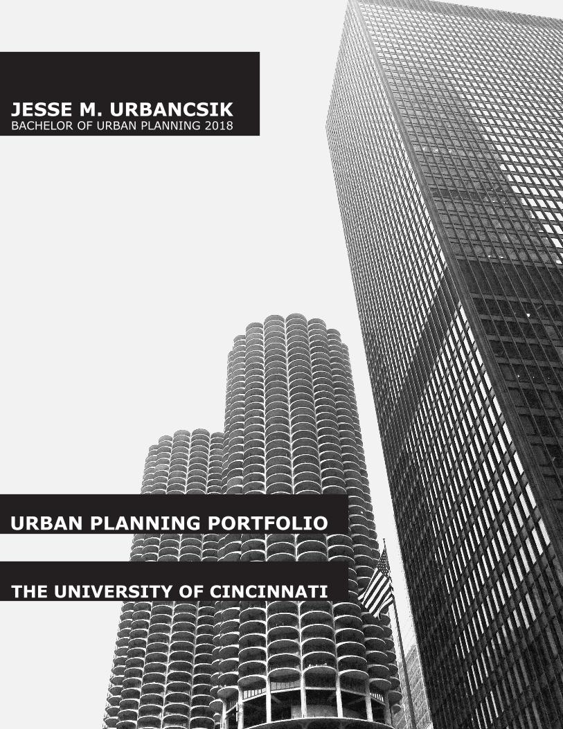
JESSE M. URBANCSIKBACHELOR OF URBAN PLANNING 2018
URBAN PLANNING PORTFOLIO
THE UNIVERSITY OF CINCINNATI

HELLO,
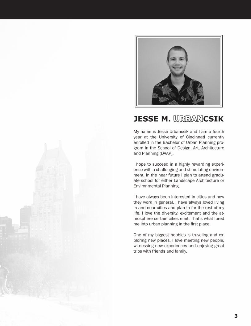
JESSE M. URBANCSIKMy name is Jesse Urbancsik and I am a fourth year at the University of Cincinnati currently enrolled in the Bachelor of Urban Planning pro-gram in the School of Design, Art, Architecture and Planning (DAAP).
I hope to succeed in a highly rewarding experi-ence with a challenging and stimulating environ-ment. In the near future I plan to attend gradu-ate school for either Landscape Architecture or Environmental Planning.
I have always been interested in cities and how they work in general. I have always loved living in and near cities and plan to for the rest of my life. I love the diversity, excitement and the at-mosphere certain cities emit. That’s what lured me into urban planning in the first place.
One of my biggest hobbies is traveling and ex-ploring new places. I love meeting new people, witnessing new experiences and enjoying great trips with friends and family.
3

RESUME

JESSE M. URBANCSIK
WORK EXPERIENCE
South Carolina Department of Transportation | Columbia, SC Intermodal Planning Intern | April 2016 – August 2016
● Worked in Mapping Department and contributed to several projects, one including mapping hurricane evacuation routes. ● Assisted with the STIP (Statewide Transportation Improvement Program) by inputting road/highway projects into the system and funding.
Cuyahoga County Planning Commission | Cleveland, OH Planning Commission Intern | August 2015 – December 2015
● Participated in the active planning process which included: current conditions, community surveys, community visions, policy developments and implementation strategies.
● Worked with the cities of Bay Village, Beachwood, Cleveland Heights, Olmsted Falls and University Heights on their respective master plans.
● Assisted with the Bay Village Community Residential Survey in which 1,200 surveys were distributed, collected, tabulated and analyzed.
The Brewery District Community Urban Redevelopment Corporation | Cincinnati, OH Urban Planning Intern | January 2015 – April 2015
● Conducted additional research to help complete a document for archaeological research and historical protection. ● Contributed to a building inventory of available spaces in Over-the-Rhine neighborhood.
Super Kmart Center | Mentor, OH Hardlines Sales Associate | April 2011 – January 2015
Herschman Architects | Beachwood, OH Intern – Shadowing Experience | May 2013 – June 2013
EDUCATION
University of Cincinnati | Cincinnati, OH Bachelor of Urban Planning, Expected Graduation: April 2018 GPA: 3.0
SKILLS & EXPERTISE
Skills Expertise ● Geographical Information Systems (GIS) ● Time Management ● Photoshop ● Communication Skills ● AutoCAD ● Creativity ● In Design ● Adaptability ● Google SketchUp ● Collaboration
Phone: 440.655.0025 Email: [email protected] Address: 9414 Freeport Ln, Mentor, OH 44060
Portfolio: https://issuu.com/jesseurbancsik/docs/jesse_urbancsik_-_urban_planning_po/1 Linked In: https://www.linkedin.com/in/jesse-urbancsik-265894b1
5
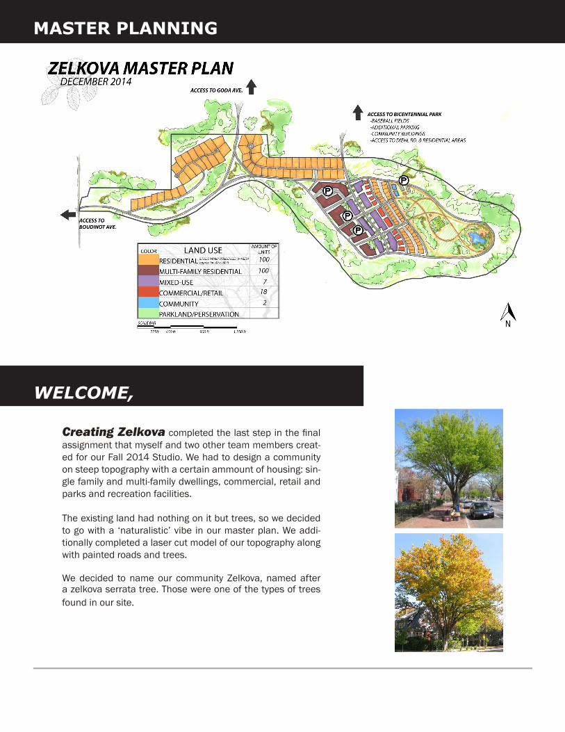
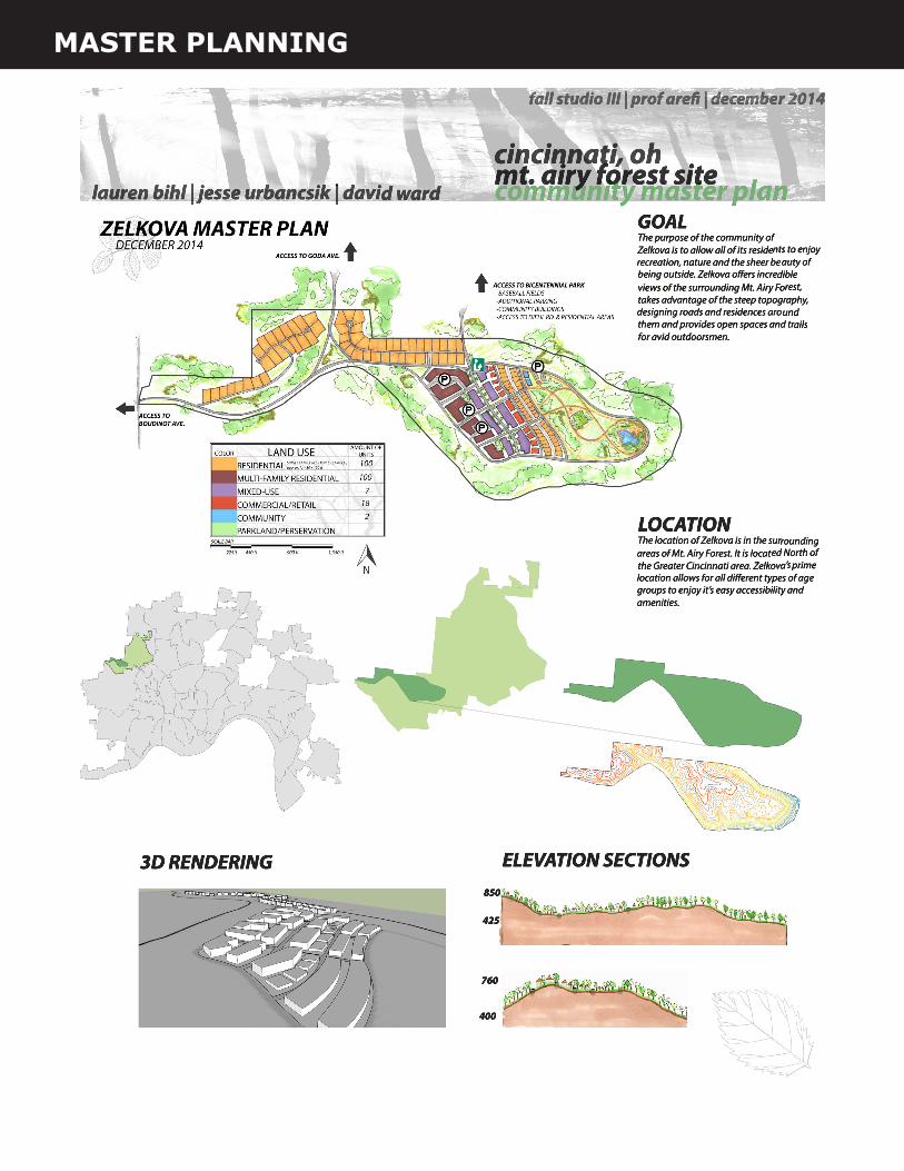
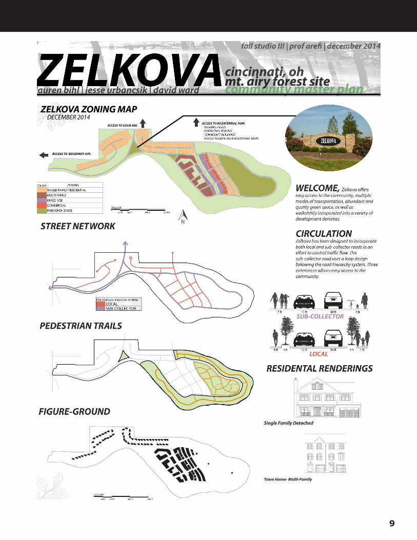
Creating Zelkova completed the last step in the final assignment that myself and two other team members creat-ed for our Fall 2014 Studio. We had to design a community on steep topography with a certain ammount of housing: sin-gle family and multi-family dwellings, commercial, retail and parks and recreation facilities.
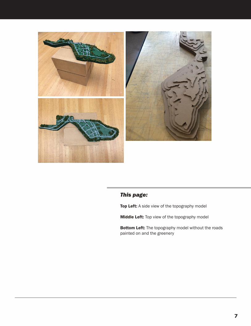
The existing land had nothing on it but trees, so we decided to go with a ‘naturalistic’ vibe in our master plan. We addi-tionally completed a laser cut model of our topography along with painted roads and trees.
We decided to name our community Zelkova, named after a zelkova serrata tree. Those were one of the types of trees found in our site.
MASTER PLANNING
WELCOME,
7
This page:
Top Left: A side view of the topography model
Middle Left: Top view of the topography model
Bottom Left: The topography model without the roads painted on and the greenery
MASTER PLANNING
9
GOOGLE SKETCH UP
This page:
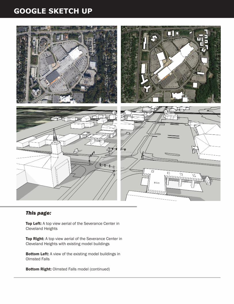
Top Left: A top view aerial of the Severance Center in Cleveland Heights
Top Right: A top view aerial of the Severance Center in Cleveland Heights with existing model buildings
Bottom Left: A view of the existing model buildings in Olmsted Falls
Bottom Right: Olmsted Falls model (continued)
11
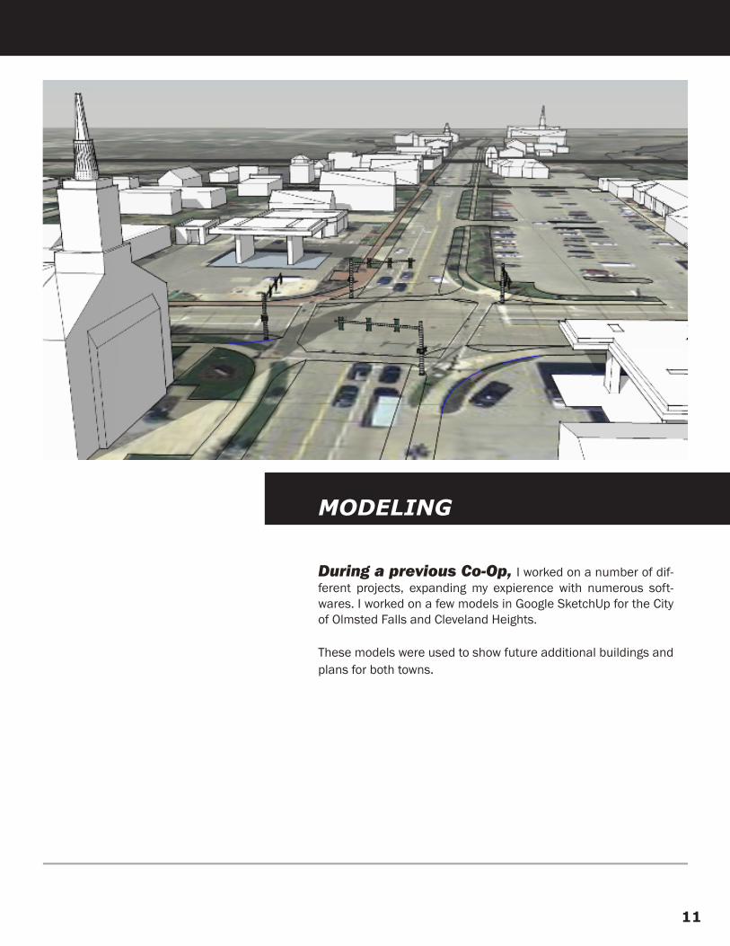
During a previous Co-Op, I worked on a number of dif-ferent projects, expanding my expierence with numerous soft-wares. I worked on a few models in Google SketchUp for the City of Olmsted Falls and Cleveland Heights.
These models were used to show future additional buildings and plans for both towns.
MODELING
PHOTOSHOP
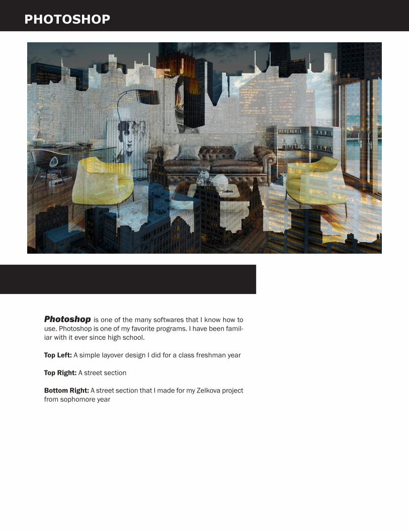
Photoshop is one of the many softwares that I know how to use. Photoshop is one of my favorite programs. I have been famil-iar with it ever since high school.
Top Left: A simple layover design I did for a class freshman year
Top Right: A street section
Bottom Right: A street section that I made for my Zelkova project from sophomore year
13
GIS (GEOGRAPHICAL INFORMATION SYSTEMS)
LAND
LEGEND
Residential
Land�ll
BRL Development Company LLC
WASSON WAY
Lauren BihlJesse Urbancsik
OWNERSHIP
BroadwellInvestment
MartinMariettaMaterials
Milton CanCompany INC
RoundBottom Hilltop PropertyLLC
BroadwellProperty
Mt. CarmelDevelopment
RiverfrontProperties LTD
NorfolkSouthernRailwayCompany
0 1,000 2,000 3,000 4,000500Feet
¯
LAND
LEGEND
0 1,000 2,000 3,000 4,000500Feet
¯
Commercial
Agriculture
Mixed Use
Industrial
WASSON WAY
Lauren BihlJesse Urbancsik
USE
Multi-Family
Institutional
Single Family
O�ce
Vacant
Parks and Rec
Railroad
Little Miami

15
WASSON WAY
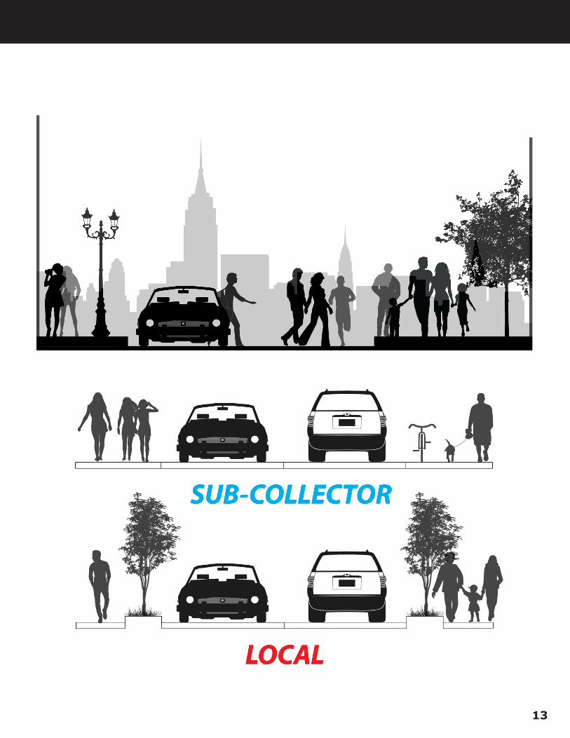
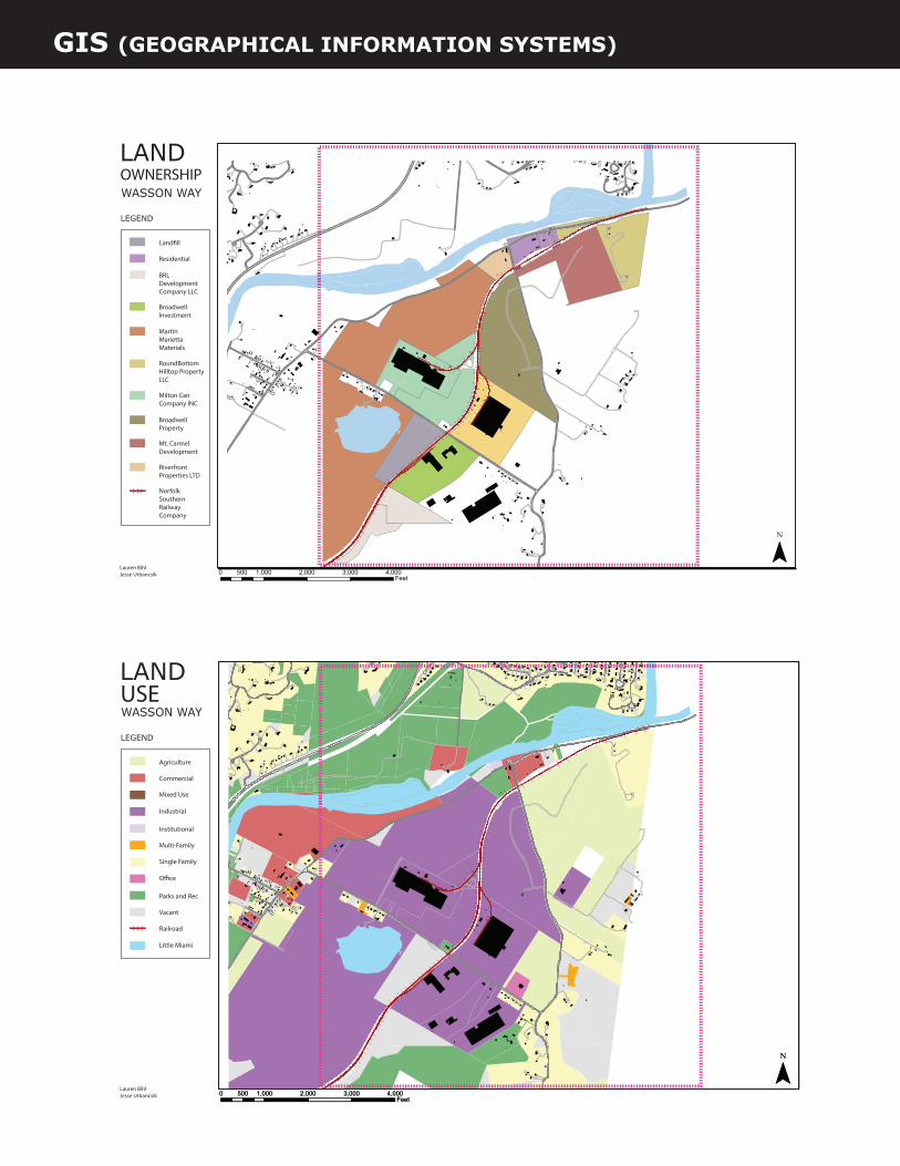
This 2016 Spring Studio our studio focused on the Was-son Way Corridor which is a proposed rail/trail route in the Great-er Cincinnati Region. Our studio was divided into ten groups and focused on our designated sections of the corridor. My partner and I chose the very last section, Section 10.
The photographs to the left show the existing railroad conditions today. The railroad length is around 8 miles long and runs all the way into Anderson Township. The map below shows the corridor along with our highlighted section to the far right.
GIS Maps for Land Use and Land Ownership are on the right.

“Cities were always like people, showing their varying personalities to the traveler. Depending on the city and on the traveler, there might begin a mutual love, or dislike, friendship, or enmity. Where one city will rise a certain individual to glory, it will destroy another who is not suited to its personality. Only through travel can we know where we belong or not, where we are loved and where we are rejected.”
― Roman Payne, Cities & Countries